Most of Dublin’s rivers, streams and watercourses have disappeared over hundreds of years as the city expanded.
At one point, there were over 60 of them flowing entirely above ground. The Liffey, the Dodder, the Santry River and the Tolka are among the few to remain uncovered but where are the hidden ones today?
Chief among Dublin’s hidden rivers is the Poddle, which runs underground for the majority of its course. For centuries it provided drinking water, powered our mills and even kept Dublin Castle safe from invasion. The Poddle, known as the Tymon over its initial overground stretch, rises in Tallaght and forms a lake in Tymon Park. It flows north-east overground for two kilometres and is joined by a branch of the Dodder, which was diverted there by medieval monks from St. Thomas Court Abbey back in 1442. The monks had dug a channel from the Dodder near Firhouse, a full 2.8 kilometres away, to strengthen the Poddle’s flow. After an underground stretch, the river reappears near the KCR (Kimmage Cross Roads) in Poddle Park before winding around the back of Kimmage Shopping Centre and into a culvert.
As the Poddle flows through Blackpitts, it’s joined by multiple underground streams, including “Tenters Water” and “the Commons Water”
As it passes through Mount Argus estate, the Poddle is afforded room to flood in a small landscaped park, crucial to sections downstream. Mount Argus was once the site of the Stone Boat, an ancient, triangular stone, shaped like the prow of a ship. Sometimes called “the Tongue”, it divided the river into two branches. One forked north-west, becoming the city water course and supplied the City Basin at St James (since filled in) adjacent to the Guinness Storehouse.
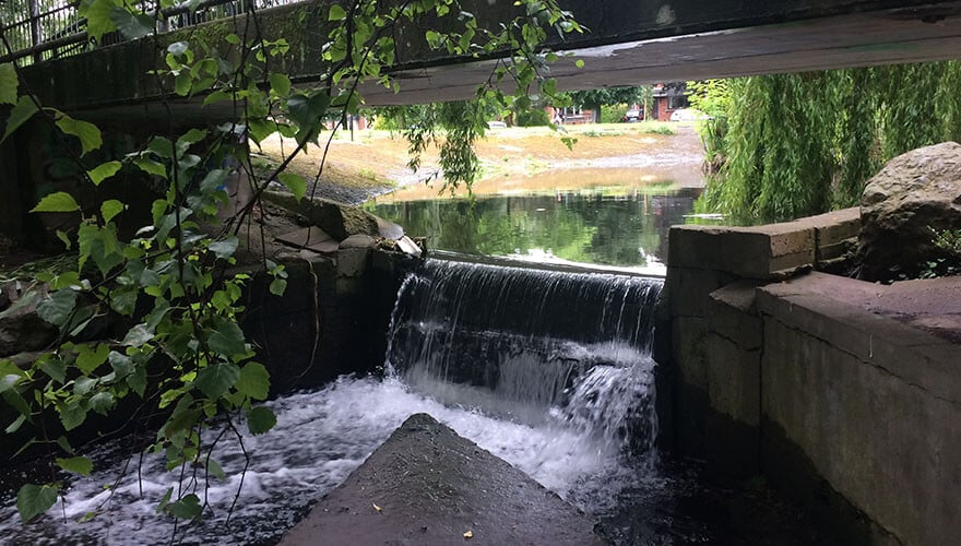
The Poddle flows under Bridge and over a Weir at Mount Argus
The Poddle then passes through Mount Jerome Cemetery, where you can spot it in several places, under the hospice in Harold’s Cross, the Grand Canal and the South Circular Road, heading north parallel to Clanbrassil Street. Back when it ran overground in this area, it used to touch the ends of old, now vanished lane-ways of saggy old cottages here, streets with redolent names like Duckers Lane and Faddle Alley, where the legendary blind Liberties poet Zozimus was born.
As the Poddle flows through Blackpitts, it’s joined by multiple underground streams, including “Tenters Water” and “the Commons Water”. A medieval mill in the area, maintained by the monks of St. Thomas Court, required a stronger flow on the Poddle and was the reason why they dug that channel diverting water from the Dodder in 1242. At the Patrick’s St/Kevin St junction, the river splits in two with both branches flowing north side by side. In fact, they used to form an island between them, which gave the cathedral the medieval Latin sobriquet San Patricio in Isola.: St Patrick’s on the Island.
On the far side of Dublin Castle, under Palace Street, the river forks one final time with one branch briefly heading west then east to join the other which continues north under the Olympia Theatre
The two branches reunite near the western end of the Iveagh Trust flats then flow north to Dublin Castle.
It was on this site in Viking times that the Poddle met the Liffey and formed Dubh Linn, the black pool that the city would subsequently get its name from. Post construction of the Castle, the river flowed along the outside of the walls of the city and castle. In the medieval era it was engineered by the Anglo-Normans rulers to wrap around Dublin Castle as a defensive moat. They dammed it to keep water levels high, hence the origin of the street name, Dame Street. On the far side of Dublin Castle, under Palace Street, the river forks one final time with one branch briefly heading west then east to join the other which continues north under the Olympia Theatre. The reunited river then flows the last few metres, going diagonally under Essex Street, the Clarence Hotel and Wellington Quay to decant out into the Liffey through a sinister looking portcullis style gate west of Millennium Bridge.
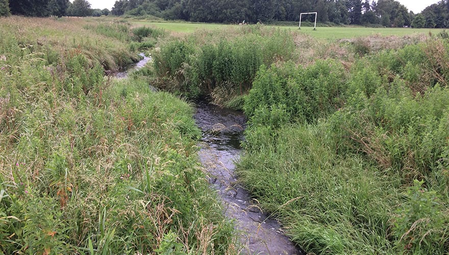
The River Tymon/Poddle near its source, as it flows out from Tymon Park
Whilst the Poddle may be the most well known of Dublin’s hidden rivers, there are many others. The Swan, which drains Terenure, Rathmines and Ballsbridge, is remembered in the name of the local shopping centre in Rathmines. It flows underground beneath Morehampton Road and Clyde Road, eventually joining the River Dodder near the Aviva Stadium. On the northside, the Naniken runs under Beaumont, eventually draining into the sea near North Bull Island. It took its name from the Nanny River in Laytown, Co Meath, which is three times bigger than the river in Dublin. The suffix “iken” means small. Others that drain into the Liffey include The Camac at Heuston Station on the southside, The Oxmanstown stream and Bradogue River on the northside near the Four Courts.
It’s clear the Poddle played a crucial role in shaping Dublin’s history over so many hundreds of years. Providing our drinking water, powering mills, providing water for brewing, tanning, distilling and market gardens. This explains why, once they learn about it, people tend to treat this modest little river with interest and affection. An affection which is, after all, no more than it deserves.